Trustees Quest

Copicut Woods

Congratulations! You’ve found the Copicut Quest. Scroll down for more adventures here!

You’re now standing in front of the remnants of the home that belonged to Isaac Miller and his family. Isaac was born in 1777—almost 250 years ago, and just one year after the signing of the Declaration of Independence! When Isaac inherited the land from his father, he began to buy surrounding land and grew Miller Farm from 60 acres to 345 acres. That’s almost seven times the size of Boston Common!

There’s more to do and see! Keep scrolling…

Now that you're here...
  • Activity Ideas
  • Explore More
  • History Tidbits
  • Property Map

Activity Ideas

Read the landscape. You can learn how people lived by exploring and observing the structures they left behind. As you look at this foundation can you find where the front door was? How about the stairs to the cellar? How many rooms were there and where do you think the kitchen was? How many rocks do you think make up the stone walls of the house foundation? If you have a piece of paper and something to write with, sketch a foundation like this and a house to go with it. Use your imagination!

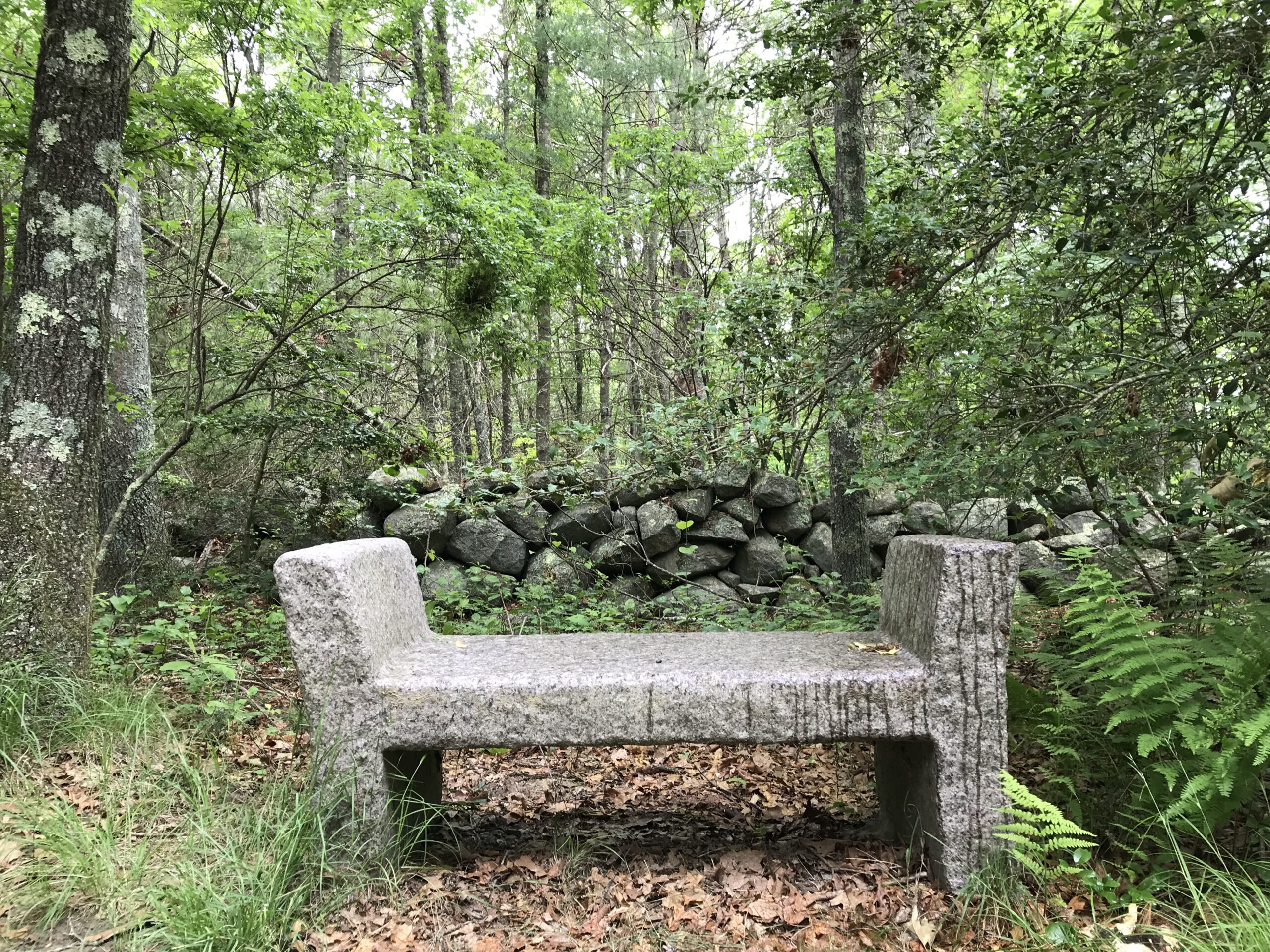
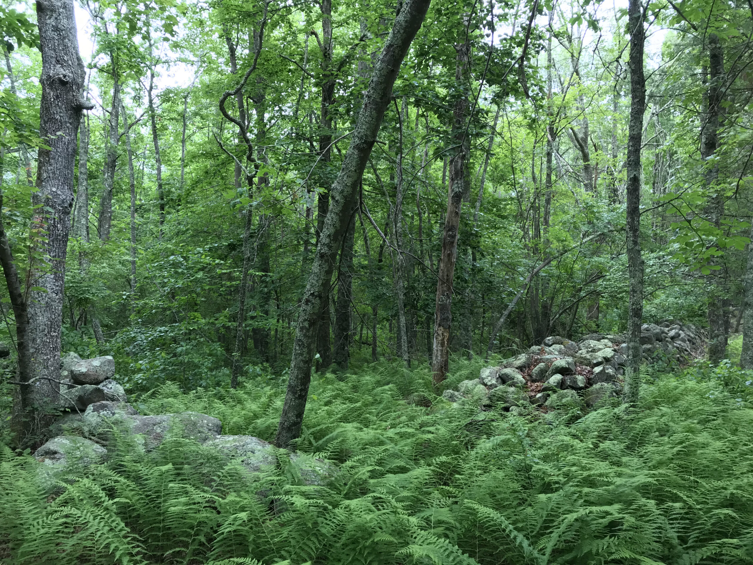
Next, head over to the stone walls. Looking at the walls around you, what types of rocks did they use – round, flat, large, small? Notice where the large stones are placed in comparison to the smaller stones. Why do you think that is? Some walls were built for livestock pastures. Others were simply to remove rocks from fields, and some were to designate property lines. There are seven miles of stone walls at Copicut Woods. As you explore, can you tell what each stone wall was built for?

Stone walls are also habitats for small animals like chipmunks, mice, and snakes. The rocks in the walls are covered with a variety of lichens. Use your magnifying lens to take a closer look.

Sit quietly and observe – what do you hear, see, or feel? How does this compare with other Trustees Quest sites you’ve visited? What are you experiencing that you don’t where you live?

Explore More

From the Miller Homestead head over to the “dry bridge” using the map to find your way. The dry bridge is a bridge made with a small granite slab and was built in the mid-1800s. The purpose of the dry bridge was to allow livestock to pass under Miller Lane.

There are many trails at Copicut Woods to explore. Looking at the map chart out a path back to your car taking new trails you have not yet explored. How wet do you think the Soggy Bottom Trail really is? What is the Meadowhawk Trail named after? Did you see them on the trail? Be sure to check out the “Ed Shed”. It’s a great spot to have a picnic or enjoy a snack.

History Tidbits

Copicut is a Wampanoag word meaning “deep dark woods.” This land has been sustaining the native biodiversity of this region for thousands of years, from the dominant white pine-oak forest and the rare Atlantic white cedar swamps, to the nearly 100 species of birds and the endangered four-toed salamander. Today, this area is part of the Southeastern Massachusetts Bioreserve and protects drinking water for more than 100,000 people!

Property Map

Join the Trustees

Enjoy 120 sites featuring inspired trails, historic homes, beautiful gardens, farms, summer camps and more.
Become a Member

Lend a Hand

Join a community passionate about a sustainable future and engaged in diverse projects across the state.
Volunteer

Support Our Work

We rely on your generous support to protect the irreplaceable landscapes and landmarks of Massachusetts.
Donate