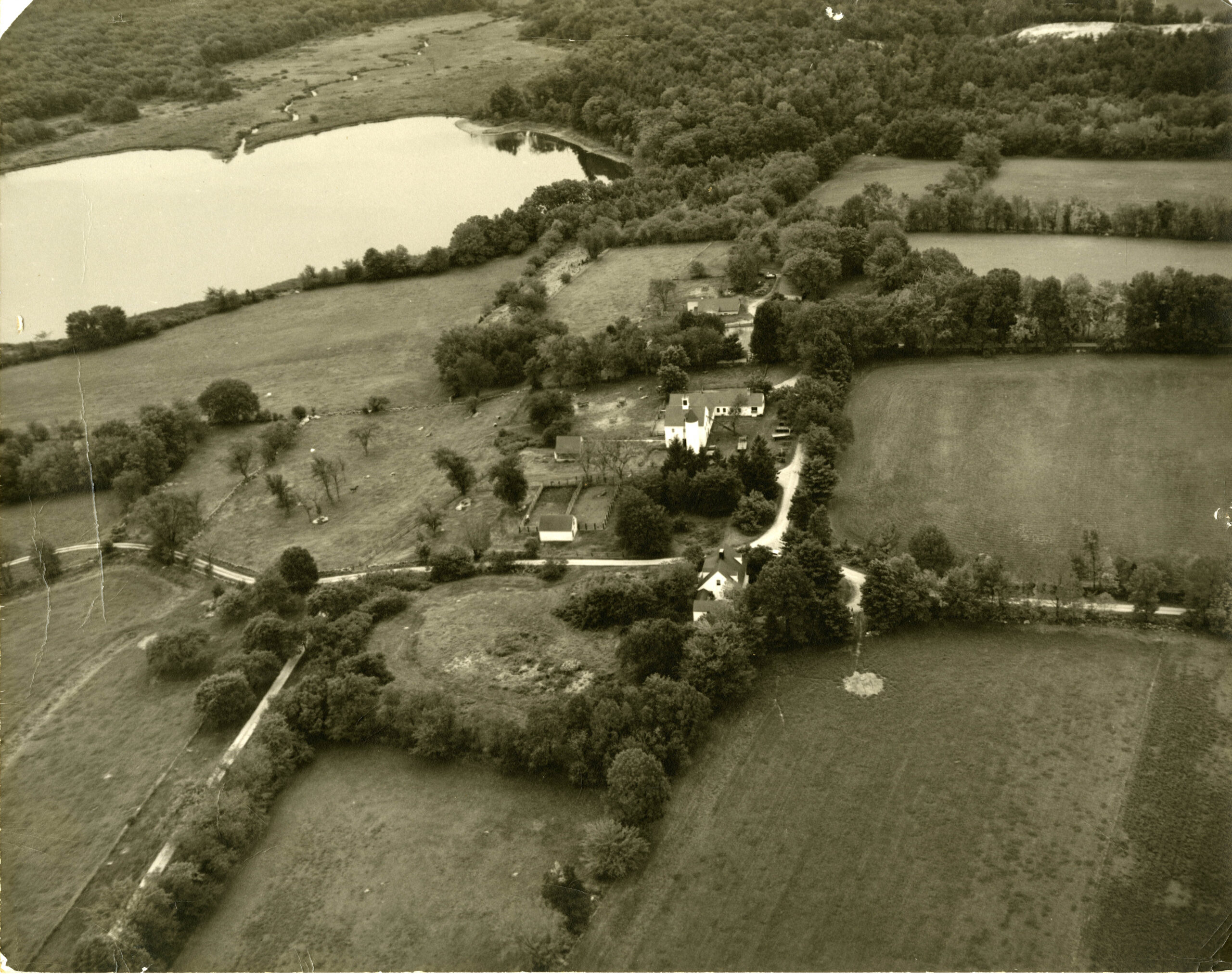
The ownership of the parcels comprising Millborn Farm is complex. It is understood that prior to the Contact Period (c. 1500-1620), this landscape was lived on and used by the Nipmuc Nation—one of New England’s largest native communities. A map on their website shows their lands as encompassing much of what makes up central Massachusetts today, as well as northeastern Connecticut and northwestern Rhode Island. The “Praying village” of Natick was very close to the Millborn Farm area and a part of the Nipmuc nation.
The land grants from the Massachusetts Bay Colony General Court to English settlers west of the Charles River began in 1643 with a 200-acre grant to Reverend John Allin—in what would become the Millborn Farm area. In 1649, land was granted by the Colony’s General Court to Robert Kayne. Land transactions were entered into between the English settlers and the Native people, but often these came much later than the land grants gifted by the General Court.
The name “Bogastowe” (now referring to Bogastowe Brook, which feeds South End Pond on Millborn Farm and eventually the Charles River) was first mentioned in Massachusetts Bay Colony records for Dedham in 1640, in acknowledgment of the land grant to Allin: “to lie in or about that place called Bogstowe.” While it has been suggested that the name derives from an Algonquin term for the valley of the Quinnebequin River, meaning “winding water,” there is no basis for this understanding.
Paul Lacroix (a prominent French author, historian, journalist, and bibliographer) has proposed an alternative origin. He suggests that “Bogastowe” may have evolved from “bog stone,” a colloquial term for bog iron ore—hydrated iron oxide minerals formed by groundwater precipitation in wetlands. Cricket Wilson (writer of “The Genesis Myth of the Lost Garrison” from the Constable Family Papers Regarding Millborn Farm in the Trustees Archives & Research Center) further elaborates in their article, stating, “[t]he derivation of ‘Bogastow’ appears to be early archaic, possibly even paleolithic. No word like it is found in the more recent Algonquin language.” Supporting this theory, archaeological research conducted between 2009 and 2012 on the stone house determined that the structure was used for ore smelting, and the presence of bog iron in the area adds plausibility to this interpretation of the name’s origin.
Lacroix suggests that “Allin’s choice of land tracts here may have been motivated by its proximity to a sparse, yet lingering [Indigenous] population in the vicinity. It seems unlikely that Allin would not have known that his 200-acre land grant appears to have been laid out in such a way as to embrace the entire area of relatively large and possibly inhabited [Indigenous] encampment at the peak of New England’s interior fur trade period, especially considering Allin’s early role in the Colony’s establishment of a policy toward civilizing and Christianizing the [Indigenous people].” Several histories suggest that a significant community of Indigenous people lived and cultivated the land as the English were moving west in what they would have perceived as wilderness.
The first English inhabitation of the landscape occurred around 1658-1660 by Nicholas Wood and Thomas Holbrook, followed soon after by Henry Leland, Benjamin Bullard, George Fairbanks, John Hill, Thomas Breck, and Daniel Morse. These men, some with families, came from Medfield, Dedham, Dorchester, or Weymouth—all early English settlements in the Massachusetts Bay Colony. Benjamin Bullard and George Fairbanks were the first English to inhabit the land that is now known as Millborn Farm.
Over the intervening years, the original acreage was divided and transferred through inheritance or sold to others. The original lots had been subdivided into parcels of varying sizes. These parcels were owned by families whose names are prominent in the histories of both Sherborn and Millis, including Bullard, Hill, Ware, and Rotman. Records indicate that the land supported three farms: the Breck/Ware property to the north (c. 1660-1926); the Samuel Bullard/Elijah Hill farm (1751-c. 1912), which was smaller than the other two just south of the Ware property; and the Fairbanks/Bullard/Mason/Rotman farm (c. 1658-1935), which crossed the town boundary and was mainly situated in Millis.
In 1935, Ruth Paine Cunningham purchased 341.4 acres in eleven parcels in Sherborn and Millis. The two parcels entirely contained within the boundaries of Sherborn were purchased in October 1935, as well as a parcel across Bullard Street (not a part of the current Millborn Farm). Two parcels crossed the town boundary line to fall in both towns (also purchased in October 1935). The remaining six parcels were located in Millis and purchased in November 1935. The ten contiguous parcels east of Bullard Street were combined to create Millborn Farm, a country home for the Cunningham family whose primary residence was in Brookline, Massachusetts at the time. To this, she added another parcel at the southern end of South End Pond, in Millis, in 1945. (This parcel was later subdivided and portions sold to the Town of Millis.)
In 1969, Ruth Paine Cunningham sold the properties to her niece and her husband, Dr. John and Sylvia Constable. The lot west of Bullard Street was sold outside the family in 1968.