The Tully Trail is a 22-mile loop trail that encircles the largely undeveloped Tully Valley in the North Quabbin Region of Central Massachusetts. From the summit of Tully Mountain to the cascading waters of Doane’s Falls, the trail connects some of the region’s most scenic properties and views.
Before You Begin
- Be sure to bring food, water, a map, and compass.
- Wear sturdy footwear and adequate clothing.
- Wear blaze orange during the hunting season.
On the TrailThe trail is somewhat regularly marked with yellow rectangular blazes and blue-purple Tully Trail markers. A stand-alone GPS unit or GPS-based mobile mapping app is strongly recommended. Be sure to frequently check your location on the map/GPS and take note of landmarks to help you find your way.
If you become lost, don’t panic. Sit down, remain calm, and try to retrace your steps with the help of the map/GPS. A few moments of thought will most likely help you regain your route. Take care when walking along those portions of the trail that follow a road. As of 2017 the Tully Trail is maintained only sporadically and by volunteers. Please be advised that many sections of the trail are difficult to follow and challenging to navigate.
Download a map of the Tully Trail.
Respect Private PropertyAt various places, the Tully Trail crosses private property. Please respect the rights of the property owners and stay on the trail.
Dogs on the TrailDogs must be on leash on the Tully Trail at all times.
Trail FloodingDuring spring run-off or heavy rainstorms, parts of the trail around Tully Lake may be under water. For current reservoir conditions, call the Tully Lake Park Office at 978.249.9150.
Parking and AccessTrailhead parking is provided at the Tully Lake Campground.
CampingExcept where noted, camping is prohibited along the Tully Trail. In the fall of 2003, a trail shelter was constructed along the Tully Trail on Royalston Falls Reservation. The shelter is located on the western bank of Falls Brook at the eastern junction of the Tully Trail and the Metacomet-Monadnock Trail. The shelter is available for use under the following conditions:
- Reservations for use of the shelter are not accepted. The shelter is available on a first-come-first served basis, but users should be prepared to share the shelter with others.
- Users are asked to leave the shelter in the condition in which they found it and to please carry out anything that is carried in.
- The use of cooking stoves is permitted. Open fires and alcoholic beverages are prohibited.
Call 978.248.9455 for more information. Walk-in tent sites are available at the Tully Lake Campground.
Exploring the Trail
The trail begins at the Tully Lake Campground, a property of the Army Corps of Engineeers, where hikers will find free parking, a map board with current information about the trail and the surrounding area, and a pay phone. During the camping season, the campground’s bathhouse will be available to hikers.
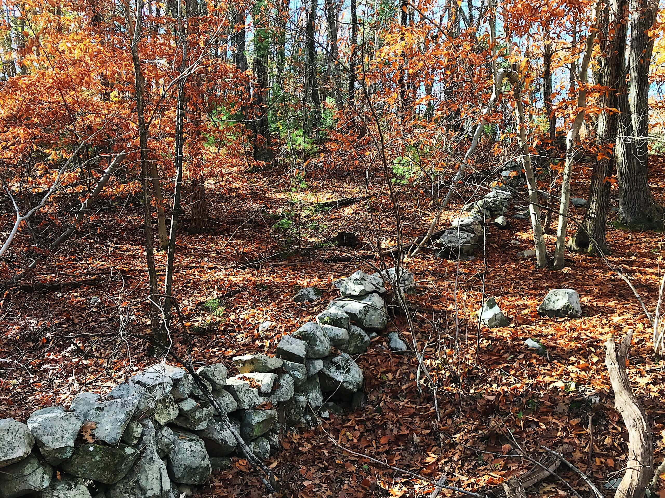
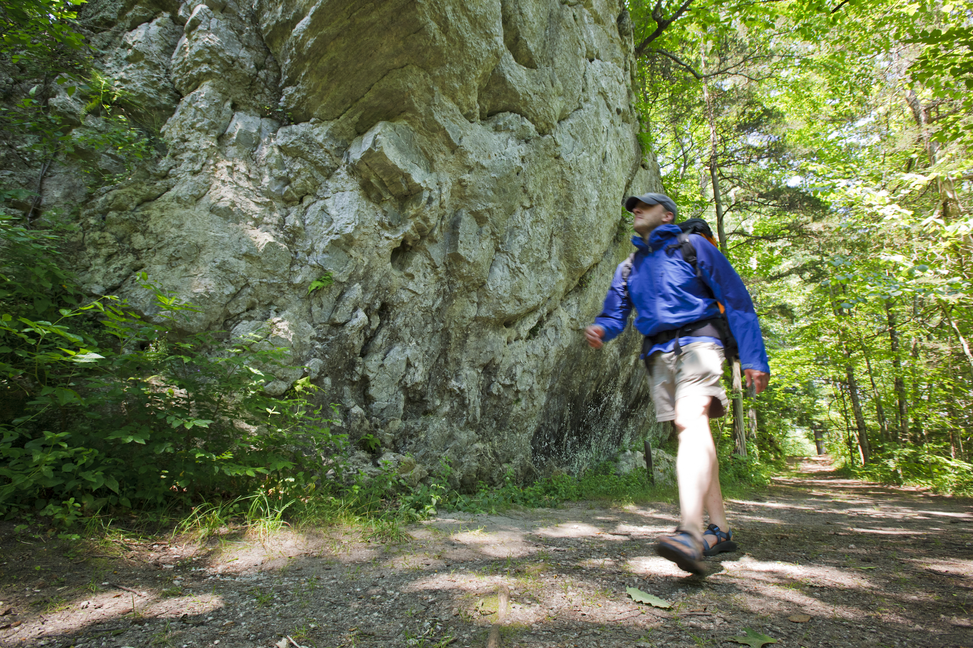
Along the eastern portion of the trail, which is mostly a single-track wilderness footpath, you’ll find a series of waterfalls and ridgeline views on three reservations managed by The Trustees. At Doane’s Falls, Lawrence Brook tumbles over a series of three falls before it reaches Tully Lake, while a short, steep side trail takes you to Spirit Falls, which is part of the Harvard Forest. Large boulders, small forested islands, and flat rock slabs are a favorite for picnickers and hikers. Along Jacobs Hill, the trail follows the ridgeline and provides spectacular views of the forested slope of Tully Mountain, Mount Grace, and the Berkshire Hills. At the northeastern end of the loop, the trail winds through a dense forest to Royalston Falls where Falls Brook plunges forty-five feet into a granite basin carved by the rushing waters.
At the northern tip of the trail loop, the Tully Trail connects to the Metacomet-Monadnock Trail (M&M Trail), which hikers can follow south to Connecticut or north to New Hampshire’s Mount Monadnock. Here Tully Trail passes also through the Massachusetts Department of Environmental Management’s (DEM) Royalston and Warwick State Forests linking the trail to more than 7,000 acres of protected forest land and a multi-use trail system open to hiking, biking, horseback riding, cross-country skiing, and snowmobiling (where appropriate). The several miles of trail that are on DEM land traverse hilly terrain through a sometimes dense forest canopy, wind through low-lying areas near wetlands like those along the Tully River, and also lead to scenic outlooks including Bliss Hill, which offers a fine view of Mount Grace. DEM also manages Orange State Forest.
As the trail heads south toward Tully Mountain, it passes through two wildlife management areas managed by MassWildlife. Both Fish Brooks Wildlife Management Area and the Tully Mountain Wildlife Management Area are open to fishing, hunting, trapping, and other passive outdoor recreation activities. Rising some 1,160 feet, Tully Mountain offers spectacular views of the North Quabbin region and a fitting reward for your hike.
Building the Trail
Endorsed in 1997 as the first project of the North Quabbin Regional Landscape Partnership and galvanized by the support of the National Park Service’s Rivers & Trails Program, the Tully Trail was completed in 2001. The trail was designed to provide the public with an exceptional hiking experience and to showcase various types of land conservation, including state forests, wildlife management areas, commercially managed forests, and privately preserved areas. The trail has led to increased trail protection efforts, such as the Commonwealth’s Tully Initiative. Though the trail grew out of a partnership of various government agencies and conservation organizations, a grassroots movement of volunteers helped make the trail possible. And while large segments of land are located on protected landscapes, the trail would not have been possible without the private landowners who granted trail easements. Today, the Tully Trail is maintained by volunteers from North Quabbin Trails Association.